 |
| Juliana, Sheri, Suzan, and Amy |
Hiked a 45-mile loop beginning and ending at Obstruction Point in the Olympics National Park. It was a fairly demanding hike, with my Garmin clocking a total of 16,467 feet elevation gain for the trip.
Day 1: Obstruction Point to Deer Park (8 miles) First day hiking was fairly easy, with plenty of sweeping vistas and steep dropoffs, though unrelenting sun took a bit of a toll. Smoke from forest fires impacted visibility, but we still had views of Mt Olympus, Obstruction Peak, Port Angeles, and Dungenes Spit, as well as multiple valleys and passes. Camped at Deer Park.
Day 2: Deer Camp to Falls Camp via 3 Forks and the Grey Wolf River (10 miles) Caught a lovely sunset from camp, then headed down a steep, but beautiful, trail through the forest to 3 Forks. Crossed Grand Creek and several additional bridge crossings before we settled along the Grey Wolf River through more forest until we reached Falls Camp. We shared our camp with several other hikers in relatively close quarters. Rain began during dinner, so we had a chilly, wet night, but nothing terrible.
 |
| Sunrise from Deer Camp |
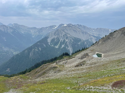
Day 3: Falls Camp to Bear Camp via Grey Wolf Pass (10 miles) Started out hiking through brush and multiple river crossings, followed by a steady uphill. A mile or two below Grey Wolf Pass, we broke out of the trees into meadows and finally a push through scree to the top of the pass. Had a scenic lunch at the pass before hiking down to the Dosewallups River. Camped at Bear Camp along the river.
 |
Looking up at Grey Wolf Pass
|
 |
| Scree field near the top of Grey Wolf Pass |
 |
| Looking down from Grey Wolf Pass |
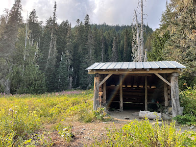 |
| Shelter at Bear Camp (aka our kitchen) |
 |
| Less than private, but welcome, toilet |
Day 4: Bear Camp to Upper Cameron via Lost Pass and Cameron Pass (6.5 miles) Short mileage day, but the passes made up for the lack of heavy mileage. We had good views from Lost Pass, incredible views from Cameron Pass. After lunch at Cameron Pass, we made our way down another scree field to a lovely camp along the stream at Upper Cameron. Ate dinner at the waterfall next to camp.
 |
| Sunrise at Bear Camp |
 |
| Lost Pass |
 |
Cameron Pass
|
 |
| Sheri at Cameron Pass |
 |
| Looking up from Cameron Pass |
 |
| View from Cameron Pass toward our campsite |
 |
| Looking down at the scree field from the pass |
 |
| Descending the scree field from Cameron Pass |
 |
| Dinner at Upper Cameron |
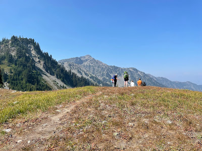
Day 5: Upper Cameron to Obstruction Point via Grand Pass, Grand Valley, and one last (steep) pass (11.2 miles with lots of steep uphill) With two significant passes, this was a tough hike day. Thankfully, the weather was cool and the views lovely. We had a bit of rain at the top of Grand Pass. Descended into Grand Valley and passed Gladys and Round Lakes before heading up to the final pass. Walked along the ridge for the last 1.7 miles to the parking lot.
 |
| Sunrise from the creek by our campsite |
 |
| Along the Grand Pass trail |
 |
| Looking back down the Grand Pass Trail from nearly the top |
 |
| Views from Grand Pass |
 |
| Beginning the descent |
 |
| Descending into Grand Valley |
 |
| Grand Valley |
 |
| Approaching our last pass of the trip |
 |
| At the pass, Olympus in the background (I think) |
 |
| Nearly done! |


Comments